 |
| The National Hurricane Center's forecast track and watches & warnings for Hurricane Ian, as of 8:00 PM on September 26. |
"Efforts to protect life and property should be rushed to completion.”
We've been on the receiving end of this warning many times. It’s the statement the National Hurricane Center issues when hurricane conditions are expected within 24 hours. We’ve been through dozens of named storms (we lost count in the mid-30s). We've been lucky, and we've also learned how to prepare for large storms. Most of the time, the storm turns out to be a near miss. But you have to be prepared; the tiniest change in the storm's track can mean the difference between a breezy day and catastrophic destruction.
.gif) |
| Hurricane Charley's forecast track and the path it actually took in 2004. |
Sometimes, these storms stagger around like a drunken sailor after last call. Hurricane Charley in 2004 was one such storm. At the time, we worked for the Sarasota Dolphin Research Program (SDRP) at Mote Marine Laboratory in Florida. Charley was supposed to make landfall on Anna Maria Island, just a few miles north of Sarasota. This was a worst-case scenario for us because that path would put us in the eyewall, on the right-hand side of the storm, which usually packs the strongest winds and the greatest storm surge flooding. But when it got about 30 miles south of us, Charley wobbled drunkenly to the right, unexpectedly making landfall on Cayo Costa (near Ft. Myers) as a category 4 hurricane. In Sarasota, we barely reached tropical storm conditions. It felt like we had dodged a bullet. The people down around Ft. Myers and Charlotte Harbor paid for our good fortune.
.gif) |
| Enhanced infrared satellite image of Hurricane Charley near landfall. |
We're thinking about this now because Hurricane Ian is currently forecast to follow a track that is very similar to Charley's forecast track. Ian is supposed to make landfall just north of Sarasota. It's a larger storm, moving more slowly than Charley. This is a bad thing; it likely means greater storm surge. We're worried for our friends and colleagues at SDRP and at the Sarasota Sailing Squadron, where we kept our previous sailboat. We know what everyone there is going through: hauling boats out of the water, removing canvas, stowing equipment, trailering small boats to inland locations, securing buildings, safeguarding computers, backing up data, etc., etc. It is exhausting, stressful work, which always takes place in hot, humid weather, with thunderstorms that grow in frequency and intensity. It takes 2 or 3 solid days of work to prep for these storms. SDRP and the Sailing Squadron have very detailed hurricane plans to make sure everything gets done efficiently and nothing is forgotten. Getting it done quickly is important because everyone also has to safeguard their homes and families. They've all been through it many times before. But this one could be different; this one may be really bad for Florida's West Coast.
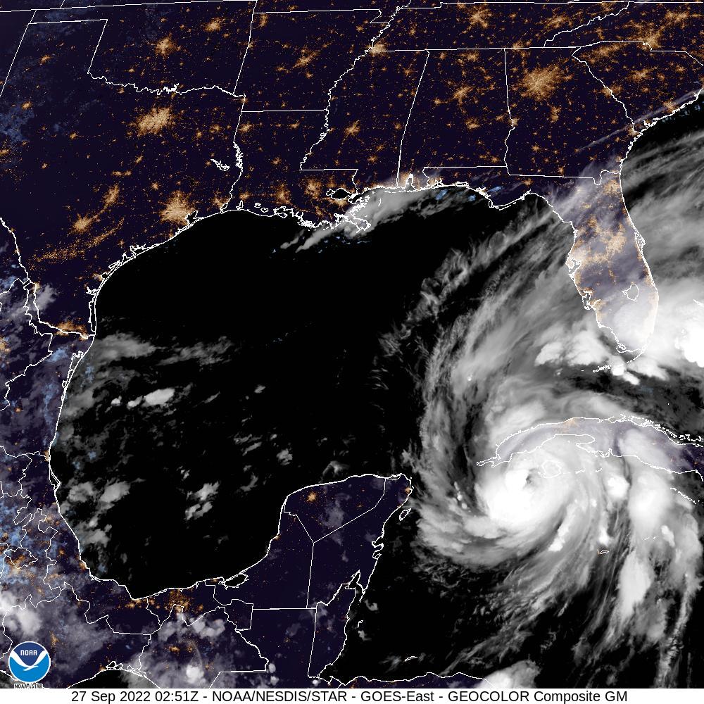
This is Hurricane Ian tonight, as we write this. It doesn't look very impressive in this image but by tomorrow morning, it is expected to intensify into a major hurricane.
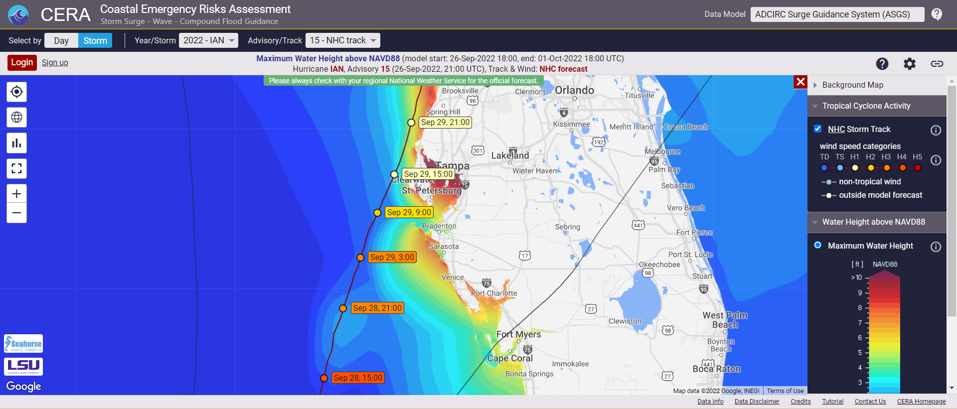 |
| A closeup of Ian's projected track and the predicted storm surge. Around Sarasota Bay, the predictions are for 8-9 feet of surge. Predictions for the northern parts of Tampa Bay exceed 10 feet. This would be catastrophic, if it comes true. |
Here on the Georgia Coast, Ian may bring low-grade tropical storm conditions and some coastal flooding, but nothing like what they are expecting around Tampa and Sarasota. We've taken actions to prepare but we're preoccupied with what is going to happen in Florida. We know the people on the Gulf Coast are paying for our good fortune. Looking at the satellite images from afar, is like watching a highway accident in slow motion. If you have any extra good karma, send it to Florida. They’re going to need it over the next few days.
No comments:
Post a Comment